Field-route planning · Windows
Stop planning routes in a spreadsheet.
Trekplan turns any list of sites into optimized field routes — grouped into day-routes, split across your teams and depots, with the driving cut down. Out comes an Excel plan your crews can work from and a Google Earth map your manager can actually look at.
Windows · 15-day free trial · one-off purchase, no subscription · runs offline on your own PC
The route — four stops
Four steps, one afternoon's work done in seconds
-
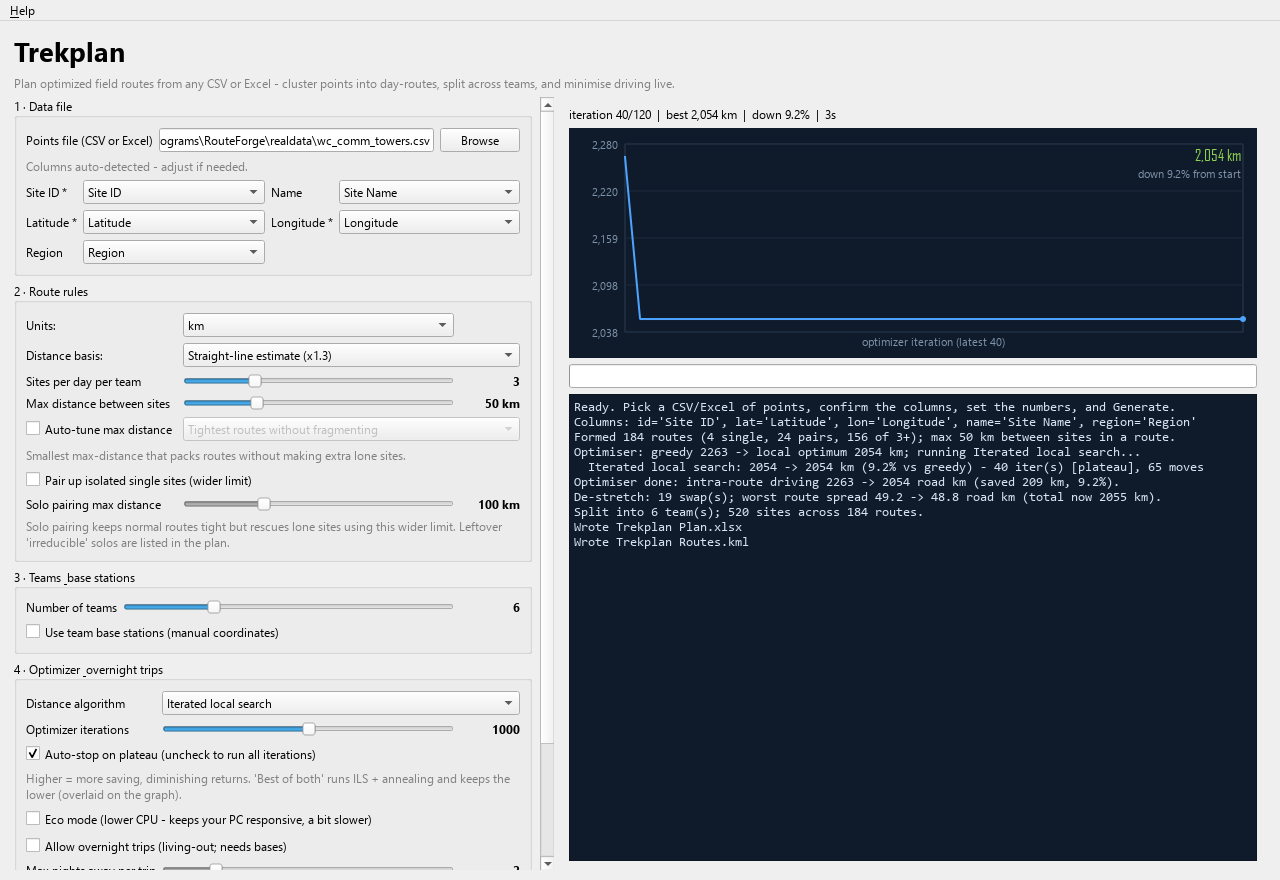
Point it at your list
Any CSV or Excel. Trekplan finds the ID, latitude and longitude columns itself — including DMS, comma decimals and semicolon files from a South African Excel.
-
Set the rules
Sites per day, how far apart they may be, how many teams, and where each team's depot is. Or let it auto-tune the distance for you.
-
Watch it optimise
A live graph shows total driving falling. It stops on its own when it plateaus, and you can cancel at any point and still keep the best plan.
-
Hand out the plan
An Excel workbook with a dashboard, one row per route and one row per stop — plus a KML you open in Google Earth.
The field kit
Built for real field work
Teams and depots
Give each team a base and Trekplan assigns routes to the nearest one, then reports true base → sites → base daily driving — so you can see which territory really costs you.
Overnight trips
For far territories it chains distant days into multi-day trips instead of driving home every night — but only where that actually beats returning to base.
No stretched routes
Every route is bounded by the distance you set, so you never get a "day" whose two ends are 90 km apart. A de-stretch pass tightens the worst offenders.
Straight to the GPS
Besides the Excel plan and the Google Earth map, every run writes GPX — one file for the whole plan, plus one per team, so each field worker gets only their own route on their handheld or phone.
Priced in money, not just kilometres
Give it a cost per kilometre and a cost per night away, and Trekplan prices the whole plan — and sleeps a team out only when that is genuinely cheaper than driving them home.
Real road distances
Optional. Plug in your own free OpenRouteService key to plan on true driving distance instead of straight-line — worth it in mountains and along coastlines.
Lone sites handled
Isolated sites are the ones that wreck a schedule. Turn on solo-pairing and they get paired using a wider limit, while the rest of your routes stay tight.
Same input, same plan
Run it twice, get the identical plan. No random shuffling between runs — which matters when you have to explain a schedule to a crew or a client.
Load capacity
How big a list can it take?
Measured on a normal laptop. Planning grows with the square of the number of points, so Trekplan tells you up front when a list is large.
| Points | Time | Memory |
|---|---|---|
| up to 500 | seconds | ~30 MB |
| 1,000 | about a minute | ~110 MB |
| 2,000 | a few minutes | ~380 MB |
| 4,000 | ~10 minutes | ~950 MB |
Journey's end — one price
Pricing
- Free for 15 days first, through the Microsoft Store
- Free bug-fix updates
- Everything it produces is yours
- Direct download: one person, up to 3 of your own computers, full refund within 14 days
Microsoft Store · then US$49.99 once (R839 in South Africa). Microsoft handles the payment and the updates, and it installs without the unknown-publisher warning.
Buy direct — US$49Windows 10/11 · ~72 MB download · secure checkout by Gumroad
Before you buy
Questions
Does my site data get uploaded anywhere?
No. Trekplan runs on your PC and makes exactly two network calls, both of which you can switch off. If you turn on Real roads, it sends your site coordinates and your own API key to OpenRouteService for driving distances — that is off by default. And at startup it asks trekplan.co.za whether a newer version exists, which sends nothing about you, your machine or your sites; turn it off under Help → Check for updates at startup. Nothing else ever leaves your machine, your plans never do, and there is no telemetry, no account, no licence key and no licence server — nothing to activate at all. The full privacy policy is one page.
What format does my list need to be in?
A CSV or Excel file with an ID and a latitude/longitude per row. Column names are detected automatically and you can correct them before running. Coordinates can be decimal degrees, comma decimals, degrees-minutes-seconds or hemisphere letters — and a pair that is impossible as written (a latitude of 95, say) gets swapped back for you when that fixes it.
Is it a subscription?
No. You buy it once and it keeps working, including if I ever stop selling it. Bug-fix updates are free. You can try it free for 15 days through the Microsoft Store before you pay anything.
Windows warns me about an unknown publisher — is that normal?
Yes. Trekplan is not code-signed yet, so Windows SmartScreen shows a warning on first run. Click More info → Run anyway. Nothing is installed system-wide; it is a single program file. The Microsoft Store version is signed by Microsoft and installs without this warning.
Can I trust the distances?
Be careful here. By default they are straight-line distances multiplied by a road factor — good for comparing plans, not exact. Even with real-road distances turned on, nothing accounts for traffic, closures, terrain or driver hours. Treat a plan as a planning aid and check it before you dispatch anyone.
Is there a Mac version?
Not today — Trekplan is a Windows program. If enough people ask, that changes.